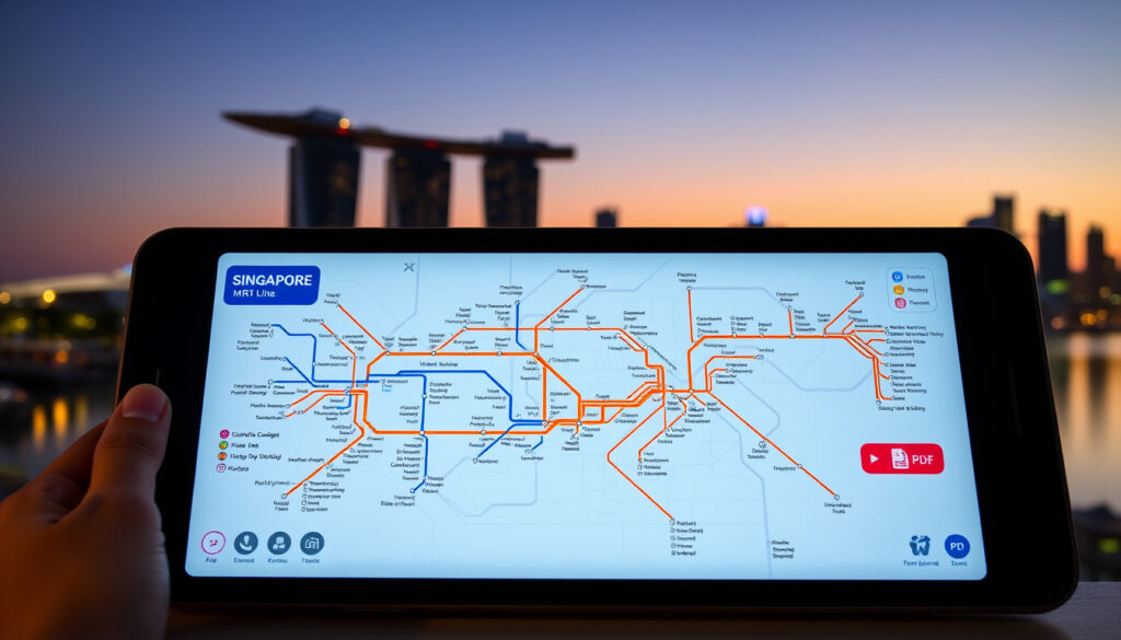
Singapore MRT Line Map: PDF Download, 2026 Plans & Apps
Whether you’re a visitor trying to make sense of Singapore’s color-coded rail network or a resident tracking the latest expansions, the MRT map is your essential companion. This guide cuts through the clutter—covering official PDF downloads, upcoming Thomson-East Coast Line stations opening in 2026, and the best tools for navigating an island-wide system that now stretches over 240 kilometers. By the end, you’ll know exactly where to find the most current map and what to expect as Singapore’s rail network grows toward 400 kilometers by 2040.
Current Major Lines: 5 (North-South, East-West, North East, Circle, Downtown) · Official Source: LTA.gov.sg · Future Expansions: Planned to 2040 · Network Operator: SMRT and SBS Transit
Quick snapshot
- Six MRT lines spanning 240km with 160+ stations (Land Transport Authority)
- Exact 2050 station count not officially released (Scribd)
- Thomson-East Coast Line stations opening throughout 2026 (Transit Maps)
- Network projected to reach 400km by 2040 (MRT Map Singapore)
The table below consolidates the key parameters of Singapore’s rail network as of 2026, drawing from official Land Transport Authority figures.
| Label | Value |
|---|---|
| Operator | Land Transport Authority (LTA) |
| Lines | North-South (NS), East-West (EW), North East (NE), Circle (CC), Downtown (DT), Thomson-East Coast (TE) |
| Total Length | 240 km |
| Station Count | 160+ stations |
| Daily Ridership | 3 million+ MRT, 200,000 LRT |
| LRT Network | 28 km, 40+ stations (Bukit Panjang, Sengkang, Punggol) |
| Map Source | LTA Rail Network page |
| SMRT Map | journey.smrt.com.sg |
Singapore MRT Line Map PDF
The Land Transport Authority publishes the official Singapore MRT system map as a downloadable PDF, updated regularly to reflect new stations and line extensions. The current version is labeled SM_Eng_(Ver280225)_Hume.pdf, dated February 28, 2025.
Official LTA PDF Download
Head to the LTA rail network page and select the system map PDF for your preferred language—the download is available in English, Chinese, Bahasa Melayu, and Tamil. The PDF includes not just MRT lines but also LRT connections, station icons color-coded by line, and markers showing stations under construction.
- Download the English system map from the Land Transport Authority official government source
- Access station-specific maps via SMRT Journeys operator portal with exit layouts and first/last train times
- Use the LTA interactive map government tool for real-time train schedules and routes
High Resolution Versions
Third-party sites like mrtmapsingapore.com offer high-resolution colored maps in multiple languages, useful for printing large-format guides or offline reference. These complement the official LTA PDF but should be cross-checked against government sources for the latest updates.
Singapore MRT Map 2026
Singapore’s MRT map for 2026 centers on the Thomson-East Coast Line expansion, with three new stations in the Woodlands area coming online throughout the year. The Circle Line also has scheduled maintenance windows in April and May 2026, affecting early-morning and late-night services.
Planned Expansions
The Thomson-East Coast Line (TEL) continues its staged rollout, adding Woodlands North, Woodlands, and Woodlands South stations to the network. Once complete, the TEL will run from Woodlands North to Sungei Bedok, significantly improving north-south and east-west connectivity.
- Thomson-East Coast Line Stage 5: Three new Woodlands stations operational in 2026
- Circle Line maintenance: Early closures and late openings scheduled April–May 2026
- Cross Island Line Phase 2: Featured in LTA virtual exhibition for future planning
Thomson-East Coast Line Updates
The TEL represents the most significant new addition to Singapore’s rail map since the Downtown Line opened. According to the Land Transport Authority, the line enhances connectivity between northern residential areas and the central business district, while also serving the Changi Airport cluster via future interchange connections.
The Thomson-East Coast Line adds a brown-coded route that intersects with five existing lines, creating new shortest-path options for commuters. Woodlands North station connects directly to the North-South Line, making Jurong East and Marina South Pier more accessible from Singapore’s north.
New MRT Map Singapore
The latest official Singapore MRT map reflects six operational lines with distinct color coding: North-South (red), East-West (green), North-East (purple), Circle (yellow), Downtown (blue), and Thomson-East Coast (brown). Each color is consistent across station signage, train livery, and the official system map PDF.
Latest Updates
The Ver280225 map (dated February 28, 2025) marks the current official baseline for Singapore’s rail network. It includes under-construction indicators for upcoming stations and references the planned Cross Island Line Phase 2 in the LTA virtual exhibition materials.
- North-South Line (NS): Jurong East to Marina South Pier
- East-West Line (EW): Pasir Ris to Tuas Link, including Changi Airport
- North-East Line (NE): Punggol to HarbourFront via Little India and Chinatown
- Circle Line (CC/CE): HarbourFront to Marina Bay loop
- Downtown Line (DT): Bukit Panjang to Expo
- Thomson-East Coast Line (TE): Woodlands North to Sungei Bedok
Recent Line Additions
The Thomson-East Coast Line stations at Woodlands North, Woodlands, and Woodlands South are newly marked on transit maps installed at these stations. The Land Transport Authority updates these maps whenever new stations enter operational status, typically aligning with school holiday periods to minimize disruption.
The official LTA PDF is the only source guaranteed to reflect the most current operational status. Third-party maps may lag by weeks or months, which matters if you’re planning travel around newly opened stations.
Singapore Future MRT Map 2030 and 2050
Singapore’s long-term rail expansion plans envision the MRT network doubling from its current 240 kilometers to nearly 400 kilometers by 2040. Three entirely new lines are planned, along with extensions to existing lines, reshaping the map significantly over the next decade and a half.
2030 Projections
By 2030, the Cross Island Line will be further along in its development phases, with Phase 2 already visible in LTA’s virtual exhibition materials. The Downtown Line and Circle Line may see additional extensions, though specific station opening dates remain subject to construction timelines and testing phases.
- Cross Island Line: Phase 2 featured in LTA virtual exhibition
- Downtown Line extensions: Potential southern extension under study
- Circle Line Phase 2: Additional stations possible east of Marina Bay
2050 Long-Term Plans
Long-term projections from LTA resources indicate MRT line maps for 2040 and 2070 showing three entirely new lines beyond current operations. The Land Transport Authority’s planning documents outline corridors connecting western industrial zones and eastern coastal areas not currently served by rail.
Projections beyond 2030 remain subject to government approval, funding allocation, and public consultation processes. The 400-kilometer figure by 2040 represents the current official planning target, but concrete 2050 station locations have not been formally announced.
Singapore MRT Map High Resolution and App
For commuters who need offline access or high-quality print versions, several options exist beyond the standard LTA PDF. Mobile apps from transit operators also provide interactive maps with real-time train arrival data, useful for daily navigation.
High Res Downloads
Third-party sites like mrtmapsingapore.com offer high-resolution versions of the Singapore MRT map suitable for A3 or larger printing. These versions typically include more color differentiation between lines and additional context like bus interchanges and nearby landmarks.
- mrtmapsingapore.com: High-res maps in multiple languages, regularly updated
- singaporemrtmaps.com: Includes LRT details for Bukit Panjang, Sengkang, and Punggol
- LTA interactive map: Web-based version with zoom and route planning
Recommended MRT Apps
The SMRT Journey app provides station-specific maps, exit layouts, and first/last train times for SMRT-operated lines. It includes the network map as a downloadable reference and integrates with real-time train arrival APIs.
- SMRT Journey: Official SMRT app with network map and real-time arrivals
- LTA MyTransport: Government app with comprehensive transit information
- Citymapper Singapore: Third-party app with multimodal trip planning
Understanding the Singapore MRT Line Map
Reading Singapore’s MRT map is straightforward once you understand its conventions. Lines are color-coded and labeled with two-letter abbreviations (NS, EW, NE, CC, DT, TE), while interchange stations appear as larger circles where two or more lines meet.
Line Colors and Abbreviations
Each MRT line uses both a color and a two-letter abbreviation for accessibility and clarity. The North-South Line is red (NS), East-West is green (EW), North-East is purple (NE), Circle is yellow (CC), Downtown is blue (DT), and Thomson-East Coast is brown (TE).
The table below shows the color coding and terminus stations for all six MRT lines currently in operation.
| Line | Abbreviation | Color | Terminus |
|---|---|---|---|
| North-South | NS | Red | Jurong East – Marina South Pier |
| East-West | EW | Green | Pasir Ris – Tuas Link |
| North-East | NE | Purple | Punggol – HarbourFront |
| Circle | CC/CE | Yellow/Orange | HarbourFront – Marina Bay |
| Downtown | DT | Blue | Bukit Panjang – Expo |
| Thomson-East Coast | TE | Brown | Woodlands North – Sungei Bedok |
The implication is that once you master the color-to-abbreviation mapping, navigating any interchange becomes a matter of tracing the appropriate colored line to its intersection point.
Interchange Stations
Interchange stations are marked with larger circles on the map and serve as transfer points between lines. Some interchanges require walking to a different platform (indicated by transfer codes like 27-2), while others offer cross-platform transfers. The map legend explains these transfer types clearly.
Using interchange stations to plan routes can save significant time, but some transfers involve long walks or timed connections. For example, switching from the North-South to East-West Line at Jurong East is a cross-platform transfer taking under two minutes, while transferring at City Hall requires walking approximately three minutes between platforms.
How to Use MRT Maps Effectively
Knowing where to find your map is only half the battle. Here’s a practical guide to getting the most out of Singapore’s MRT system maps for daily commuting, trip planning, or exploring new areas.
Finding Maps at Stations
- Station entrances: Printed maps displayed near fare gates
- Platform level: Larger maps at each platform showing the full line
- Station exits: Exit maps showing surrounding landmarks and bus stops
- Digital displays: Real-time train arrival boards include route maps
Reading Construction Updates
The LTA system map marks stations under construction with “U/C” indicators, helping you identify which parts of the network are not yet operational. During major expansion periods, these markers can occupy significant portions of the map.
Planning Off-Peak Travel
Circle Line maintenance windows in April and May 2026 will affect early-morning and late-night services. Check the SMRT Journey app or LTA website for updated timetables during these periods. For regular commuters, using the map to identify alternative routes during closures can save significant waiting time.
MRT Expansion Timeline
Five timeline points, one pattern: Singapore’s rail network is expanding in defined stages rather than all at once.
| Period | Milestone |
|---|---|
| LTA Map Version Ver280225 released | |
| Thomson-East Coast Line Woodlands stations operational | |
| Circle Line early closure and late opening | |
| MRT expansion to 400km with three new lines | |
| Long-term rail expansion completion |
What’s Confirmed and What’s Not
Confirmed
- Six MRT lines operational per LTA official network page
- PDF maps available at LTA.gov.sg with current Ver280225
- Thomson-East Coast Line new stations opening 2026
- Network spans 240km with 160+ stations as of 2026
- LRT network covers 28km with 40+ stations
Unconfirmed
- Exact 2050 station count—official figures not yet released
- Precise Cross Island Line Phase 2 opening date
- Full details on three planned new lines beyond 2040
- Specific 2026-dated MRT map PDF (latest remains 2025-02-28)
Today, more than 160 stations across six MRT lines span the island. This 240km system has over three million daily ridership.
— Land Transport Authority, Official Rail Network Page
The MRT lines are estimated to double in range with a total length of nearly 400 kilometers by 2040.
— MRT Map Singapore, Expansion Projections
For visitors and daily commuters alike, the Singapore MRT map is more than a navigation tool—it’s a snapshot of one of the world’s most efficient urban rail systems. The Land Transport Authority’s commitment to publishing official PDFs and interactive maps means you don’t have to rely on outdated third-party sources. Download the latest LTA map today, and watch for Thomson-East Coast Line station openings throughout 2026. By 2040, Singapore’s rail network will nearly double in length, and the maps you use today will look quite different.
Related reading: Sindo Ferry from HarbourFront MRT · Sentosa SEA Aquarium via HarbourFront MRT
Singapore’s MRT network expands ambitiously through projects like the Cross Island Line Phase 1, now halfway through Phase 1 tunnels with a 2030 opening and detailed station maps.
Frequently asked questions
How do I read the Singapore MRT line map?
The MRT map uses color-coded lines with two-letter abbreviations (NS, EW, NE, CC, DT, TE). Find your origin and destination on the colored lines, trace the route, and identify interchange stations where you may need to change lines. Larger circles indicate interchange stations, while the map legend explains transfer codes and line colors.
What colors represent each MRT line?
North-South is red, East-West is green, North-East is purple, Circle is yellow, Downtown is blue, and Thomson-East Coast is brown. These colors are consistent across station signage, train branding, and the official LTA map PDF.
Are there LRT lines on the MRT map?
Yes. The official LTA system map includes LRT lines serving Bukit Panjang, Sengkang, and Punggol. These are shown in gray and marked with BP, SK, and PG abbreviations. They connect to specific MRT stations for onward travel across the island.
How often are Singapore MRT maps updated?
The LTA updates the official system map PDF whenever new stations become operational, typically aligning with school holiday periods. The current version is Ver280225, dated February 28, 2025. Third-party maps may update less frequently, so always verify against LTA.gov.sg for the latest status.
Can I use the MRT map offline?
Yes. Download the official LTA PDF for offline reference on your phone or tablet. The SMRT Journey app also includes downloadable network maps that work without internet connectivity, though they may not reflect the most recent station openings until updated.
What is the newest MRT line in Singapore?
The Thomson-East Coast Line (TE, brown) is the newest addition to Singapore’s MRT network. New stations at Woodlands North, Woodlands, and Woodlands South are opening throughout 2026, extending the line from Woodlands North to Sungei Bedok once fully complete.
Does the MRT map include bus interchanges?
The official LTA system map marks major bus interchanges near MRT stations, shown as bus icons adjacent to the relevant station circles. Third-party maps often include additional landmarks and surrounding street grids for easier orientation above ground.
More related posts
 LTA Renew Road Tax: Step-by-Step Guide for Singapore Drivers
 Uhm Jung-hwa: Why She Never Married, Madonna of K-pop & Career
 Why I Stopped Taking NMN: 7 Reasons & What to Do Instead
 Luxury Coach to Genting from Singapore: Prices & Schedules
 Oak Ville @ AMK – October 2025 BTO Launch Guide
 Cream of Mushroom Soup – Simple Recipe and Variations
 Lolla Restaurant Singapore Closing – Timeline, Staff Reactions, Legacy
 A Knight of the Seven Kingdoms Episodes: Guide & Season 2 News